
A sluggish weather system is persistently delivering heavy rain to northeastern Nova Scotia, with Cape Breton experiencing the most intense effects of the storm on Saturday evening.
Environment and Climate Change Canada has issued orange and yellow alert rainfall warnings for these areas. Intense downpours and thunderstorms are causing rainfall rates of 10 to over 20 millimetres per hour, resulting in a significant risk of localized flooding and dangerous travel conditions.
On Saturday evening, thousands of customers of Nova Scotia Power were left without electricity. The number peaked at 40,000 in the afternoon but decreased to 7,000 by evening.
A local state of emergency is still in effect across Inverness, Richmond, and Victoria counties due to severe flooding and extensive damage reported late Saturday afternoon. Many roads remain closed, and conditions are hazardous.
Cape Breton
The system has unleashed torrential rain across the island, with widespread totals ranging from 100 to 200 millimetres recorded throughout Saturday. Some private weather stations in Richmond County reported totals exceeding 200 millimetres, leading to washouts and localized flooding.
The community of Eskasoni recorded rainfall rates of 20 to 30 millimetres per hour at the storm’s peak and has surpassed the 200-millimetre threshold.
Rainfall is set to continue, sometimes heavily, through Saturday night. Victoria and Cape Breton counties are expected to receive the most significant rainfall overnight, accumulating an additional 20 to 30 millimetres, with locally higher amounts possible. On Sunday, scattered showers will bring another two to five millimetres for most areas, while Victoria and Cape Breton counties may see an additional five to 10 millimetres throughout the day.
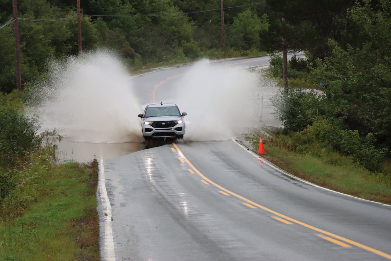
An RCMP vehicle drives through water from a brook that overflowed on Route 4 near South Side River Bourgeois, Richmond County. (Tom Ayers/CBC)
Northeastern regions
Guysborough, Antigonish, Pictou, along with northern Colchester and Cumberland counties have also reported heavy rainfall, with widespread totals of 40 to 70 millimetres and some localized amounts approaching 100 millimetres.
Rainfall is expected to persist tonight into Sunday, with storm totals projected to reach between 70 to 150 millimetres by Sunday evening.
Central regions
Rain will continue Saturday night, gradually giving way to lingering showers on Sunday.
Most central areas can expect an additional five to 10 millimetres of rain by Sunday evening, with potentially higher amounts in northern Colchester and Cumberland counties.
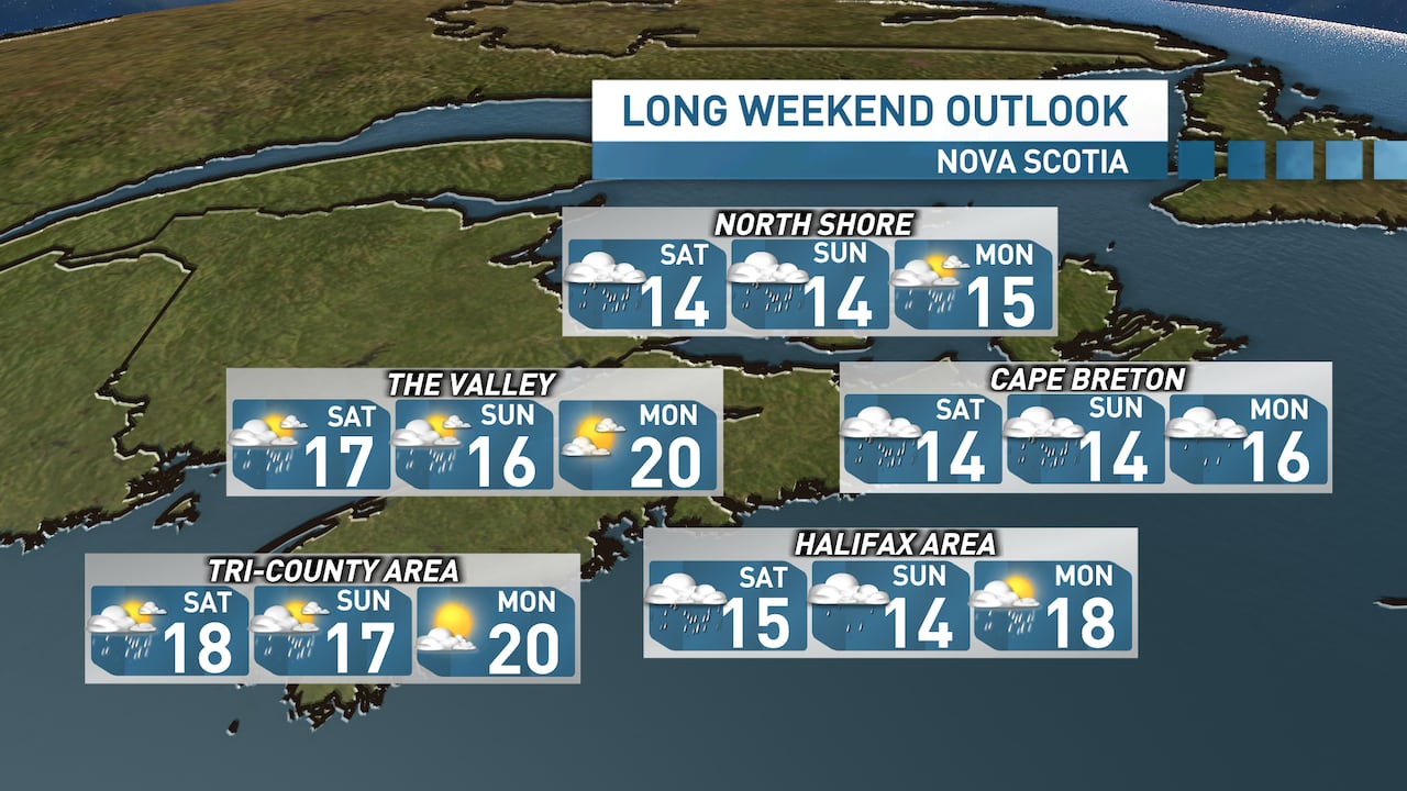
Temperatures in central regions will remain cool, reaching highs in the mid-teens through Sunday, accompanied by northerly winds gusting at 50 to 60 km/h.
On Monday, a mix of sun and clouds is expected, along with a possibility of lingering showers and warmer temperatures.
(Ryan Snoddon/CBC)
Western regions
In the western part of the province, regions such as the western Annapolis Valley, South Shore, and Tri-County can expect lingering showers through Sunday. Sunny intervals are likely for Annapolis, Digby, Yarmouth, Shelburne, and Queens counties. High temperatures will remain in the mid- to upper teens, with winds gusting at 40 to 50 km/h.
On Monday, lighter winds, abundant sunshine, and temperatures are expected to rise into the upper teens and low 20s.
MORE TOP STORIES
-
Lunenburg eases water restrictions following dam breach
-
Historic African Nova Scotian community gets close to $200K for wildfire prep
-
Halifax construction firm tied to convicted drug dealer investigated for alleged tax scheme
-
‘I’d probably be dead’ without it, say New Glasgow shelter users defending beleaguered facility
-
Atlantic International Film Festival spotlights East Coast stories, global perspectives
-
‘Stayin’ in Canada’: These artists halt sales to U.S. amid new 50% tariff on original art
Tag: rewrite-pending

